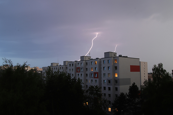
Two major lightning networks track strikes above the Arctic Circle. One shows a dramatic fivefold increase over the past decade; the other shows minimal change. If you track climate risk for northern infrastructure, that gap means you lack a solid baseline for planning.
There’s a scientific consensus, but it’s hidden in specialist literature from 2024. Most risk analysts haven’t come across it. The conflict comes down to detection methods, not whether Arctic lightning is growing. This article explains the wildfire-to-permafrost chain. It also shows how to measure its scale like climate scientists do.
Main Takeaways:
- Arctic lightning increased fivefold over the past decade. This is because warming destabilizes the atmosphere, triggering more thunderstorms.
- Two monitoring networks show conflicting trends. This is due to different detection methods and timeline lengths, not disagreement about the increase.
- Lightning fires burn away tundra insulation. That thaws permafrost and releases carbon. This speeds up warming, creating a cycle that reinforces itself.
- Each 1°C of warming drives a 12% increase in lightning activity globally.
- A 2019 thunderstorm passed within 27 miles of the North Pole.
Mitigate Lightning Risks with Density Data
Learn how data based on ground strike point density (Nsg) creates more accurate lightning risk analysis than previous methods.
Why Arctic Lightning was Historically Impossible

Every bolt of lightning on Earth starts the same way: warm, humid air rises into colder air above. This creates tall clouds with strong updrafts. Ice crystals bump into each other in these clouds. This strips electrons and separates charge. Eventually, the voltage gap gets too big. The atmosphere discharges, and you see lightning.
Scientists call the warm-below, cold-above layering that drives this process “convective instability.” It’s the engine behind every thunderstorm. Picture a pot of water on a stove. The burner heats the bottom layer, that layer rises, and the whole pot begins to churn. Lightning needs the lowest layer of the atmosphere to act as that burner.
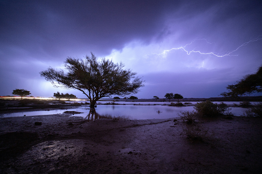
In the Arctic, the burner was always off, until recently. Surface air stayed cold and dry, and solar heating was too weak and too seasonal to build the instability thunderstorms demand. No instability meant no updrafts. No updrafts meant no Arctic lightning.
Now, the Arctic is warming roughly four times faster than the rest of the planet. Research suggests each 1°C of warming drives a 12% increase in lightning activity globally. That means the Arctic’s exposure trajectory is compounding faster than any other region on Earth.
As sea ice retreats, the open ocean absorbs solar energy that ice once reflected. The lower atmosphere heats up. Warm, moisture-laden air from lower latitudes is now pushing northward and moving over the cold surface air. This stacking creates a kind of instability that the region has never produced on its own.
In August 2019, that process generated a thunderstorm about one mile above the sea ice, passing within 27 miles of the North Pole. Researchers confirmed a warm air intrusion overrode the frigid surface layer. This triggered convection detached from the ice below, as reported in Advances in Atmospheric Sciences.
It’s not the rarest lightning in the world, but near-North-Pole lightning is extremely rare. And that event wasn’t a one-off. Since 2019, concentrated bursts of lightning have appeared north of 80°N in most summers. Each burst was linked to intense Siberian heat and steep temperature gaps between land and ocean, as reported in MDPI.
Arctic Lightning Frequency

There is a clear Arctic lightning increase happening. Arctic lightning detection methods vary. This means that global systems tracking lightning above the Arctic Circle show conflicting data.
Why the Numbers Disagree
The World Wide Lightning Location Network (WWLLN) uses ground-based sensors to detect very-low-frequency radio waves. It picks up about 30% of all lightning globally. Its strength lies in consistency over long time spans, especially for high-energy strokes.
The WWLLN recorded fewer than 50,000 strokes north of 65°N in 2010. By 2020, that count had climbed to roughly 250,000.
Vaisala’s GLD360 network operates on a different frequency band. It has sharper sensitivity to individual cloud-to-ground strokes. It’s a more precise instrument per event, but its Arctic record only begins around 2012. During that 8-year span, GLD360 detected no clear upward trend.
Three factors explain the split:
- The networks respond to different radio-frequency signatures. They sample different slices of total lightning activity.
- GLD360’s baseline is too short. In a place where one big storm can make up most of a year’s total, eight years aren’t enough to tell a trend from natural ups and downs.
- Neither network has the same sensor coverage above 65°N that it does at mid-latitudes.
No satellite backup exists. The main orbital lightning sensors, GOES GLM and ISS-LIS, reach only about 55°N, according to NASA.
What the Scientific Consensus Says
The honest answer as of 2026 is that the direction of the trend is confirmed. The exact size remains uncertain, because monitoring above 65°N hasn’t caught up to the phenomenon it’s tracking.
A deeper problem compounds the measurement gap. Climate risk modeling traditionally relies on historical data distributions to project future exposure. When the underlying system is shifting, those distributions no longer hold. Scientists call this “non-stationarity.” Arctic lightning risk models from before 2015 likely underestimate current and future exposure.
The atmospheric conditions fueling Arctic lightning are growing stronger. Additionally, the events are becoming more frequent and more extreme. That gap between direction and size matters, because Arctic lightning doesn’t just produce thunder. It sets fire to landscapes loaded with ancient carbon.
Turn Conflicting Data Into Defensible Risk
When Arctic baselines don’t agree, you still need IEC 62305-2-ready inputs and documented outputs for stakeholders, insurers, and audits.
The Climate Change Feedback Loop

Arctic lightning sets off a chain reaction:
- A strike ignites remote boreal or tundra vegetation.
- Fire strips away the insulating ground cover.
- Permafrost thaws, releasing trapped carbon as CO2 and methane.
- Warming speeds up.
- The atmosphere grows more unstable, and more lightning follows.
- More lightning ignites more fires, causing a self-reinforcing cycle.
In Canada’s boreal forests, lightning accounts for roughly 90% of all burned area. These fires ignite in roadless terrain where crews can’t arrive for days or weeks. Flames burn into peat and organic soil layers, smoldering underground for months. Some survive an entire winter beneath snow and re-emerge the following spring.
Permafrost covers roughly five million square miles of the Arctic, keeping the ground frozen year-round. Its upper layers hold vast stores of organic carbon. Ice has locked dead roots, plant matter, and microbial material in place for centuries. Intact tundra vegetation above it acts as a blanket, reflecting sunlight. This keeps the permafrost below its thaw point even during warm summers.
When wildfire strips that blanket away, bare soil absorbs heat directly. The permafrost thaws, and organic material breaks down. CO2 and methane escape into the atmosphere.
In 2024 alone, wildfire carbon emissions north of the Arctic Circle reached 42.3 Tg C, the second-highest total in two decades, as reported by NOAA.
Beyond the fires, tundra ecosystems face habitat loss, vegetation shifts, and soil destabilization. All of this impacts not only the populations that live in the area, but the ability to build and protect infrastructure.
Validate Protection Decisions For Northern Sites
If you operate remote energy, mining, telecom, or port assets, pressure-test a site-specific lightning risk workflow against today’s strike patterns.
Assess Arctic Lightning Risk with Skytree Scientific

Skytree Scientific draws on the same lightning detection networks and site-specific strike data that Arctic researchers rely on. Our platform delivers defensible risk documentation grounded in the most current atmospheric conditions rather than outdated regional averages.
Book a demo to see how Skytree Scientific approaches lightning risk assessment for infrastructure exposed to changing strike patterns.
FAQs about Arctic Lightning
If I’m tracking climate risk for infrastructure in northern regions, which Arctic zones face the steepest lightning increases?
Northern boreal forests face the steepest projected increase, roughly doubling by 2100. They combine rapid warming with dense, burnable vegetation. Boreal zones serve as both fuel for fires and insulation for permafrost, amplifying cascading risk. The continental US baseline is 1.5x for comparison, making Arctic increases disproportionately high.
Is increased Arctic lightning a direct risk to people and operations?
Yes, increased Arctic lightning creates direct hazards. Arctic shipping routes opening with sea-ice retreat now face more frequent storms during navigation windows. Remote energy and mining operations deal with growing infrastructure exposure. Wildfire threatens Indigenous communities’ traditional lands and subsistence practices. Remote facilities operate in regions with limited fire suppression and no historical lightning-protection planning.